Evaluating the Potential of Unmanned Aircraft Systems (UAS) in Nursery Management
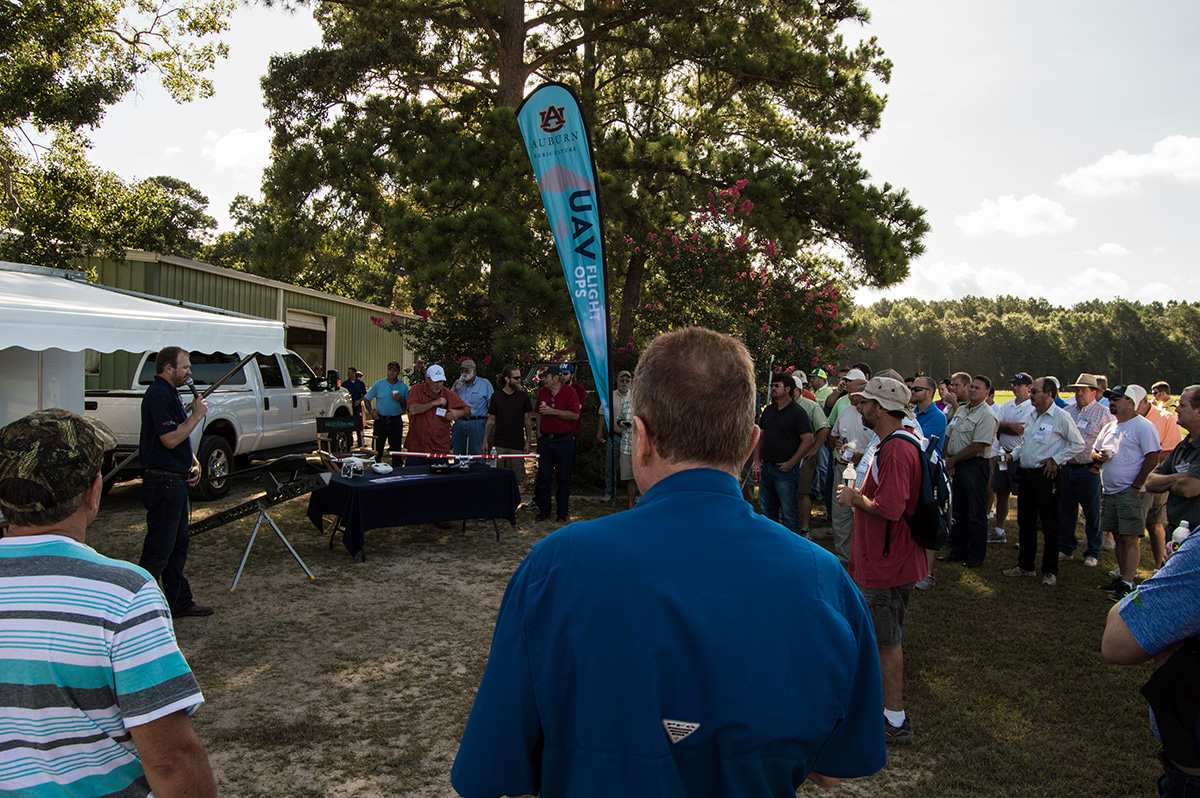
In late 2014 and early 2015, the remote sensing industry witnessed a revolutionary change with a large increase in the availability and usability of Unmanned Aircraft Systems (UAS), commonly referred to as 'drones'. It used to be that unmanned systems were part of the RC (Radio Control) Hobby Clubs and it required a very talented person to fly the aircraft in a reliable manner. However, with the recent changes in technology, UAS can now fly autonomously, following a pre-programmed flight path allowing researchers to focus on the imagery being taken, rather than the flight parameters. As researchers and entrepreneurs have started to widely use UAS, the number of sensors available for the aircrafts and their applications has grown exponentially and include areas such as the motion-picture industry, real-estate, forestry, agriculture, mining, and surveying.
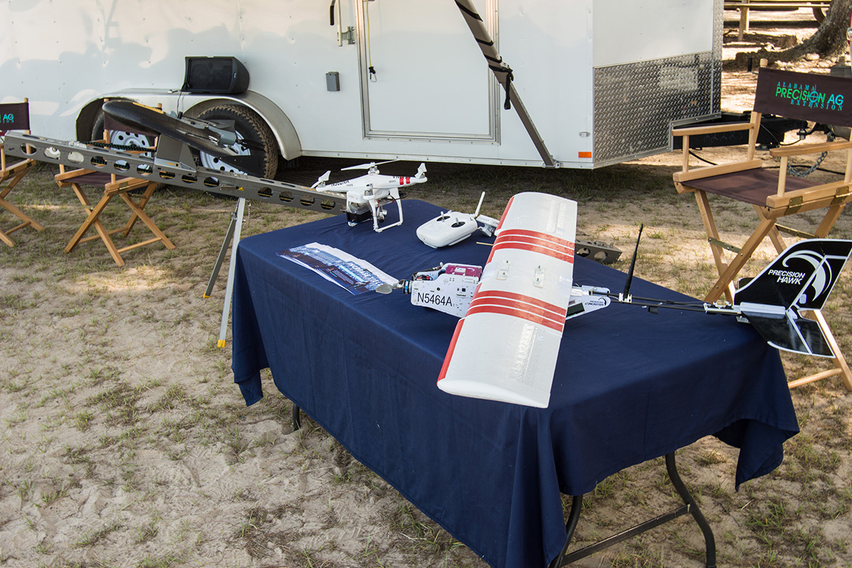
 In April of 2016 Auburn started some exploratory work using UAS to generate a time series of visible and near-infrared images, tracing the growth and establishment of seedlings at Arborgen's SuperTree nursery near Shellman, GA. The proposal was to conduct flights five times throughout the growing season with the first flight occurring immediately after sowing, but before full germination, and the final flight right before lifting. At each growth stage, two flights were conducted, the first utilizing a Trimble UX5 outfitted with a 24 mega-pixel camera allowing for the generation of high-resolution imagery as well as the creation of 3-dimensional point clouds. The second flight was with Sensefly's eBee Ag carrying a Sequoia multi-spectral camera taking images in the visible as well as the near-infrared part of the light spectrum.
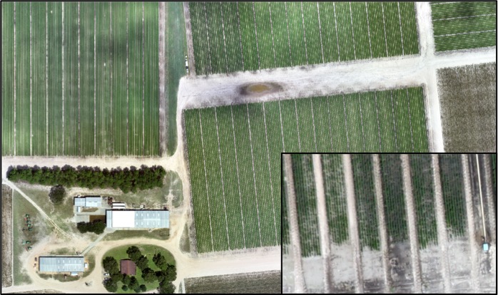
The high-resolution visual imagery that was created during each flight allowed for a quick visual analysis of the entire nursery. Since the imagery was high-resolution, it was possible to zoom in closely and look at problematic areas, identifying spots within the nursery that may require additional attention. Figure 1 is an image of part of the 160-acre area being monitored with the inset picture demonstrating the resolution at which the images can be viewed. While the visual image is an excellent tool for determining problems, it is difficult and time-consuming to closely scan each row in the image looking for areas that may be of concern. For this reason, at each stage of growth, a multi-spectral image was taken with the anticipation that by creating vegetative indices, problematic areas could be easily and quickly pinpointed. One of the most common vegetative indices used in agriculture is the Normalized Difference Vegetative Index (NDVI), which in general terms measures the 'greenness' of a plant. Applying this index to pine nurseries would suggest that healthy trees would show up as green in the image, with less healthy areas being orange or yellow, and bare earth as red.
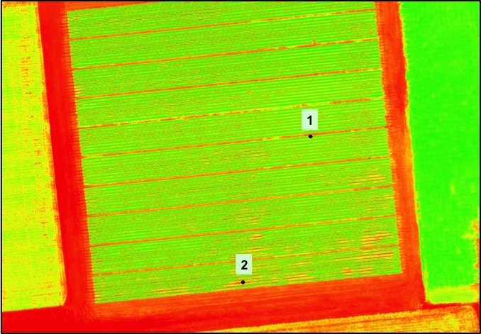
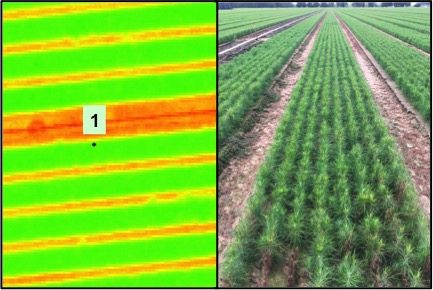 During each site visit visual and NDVI images were generated for the site. As the seedling's canopy started to close, the NDVI images became increasingly useful in identifying problematic areas. For example, in Figure 2, two areas were identified (Areas 1 and 2) and inspected closer. The NDVI image of Area 1 indicates that this are in the NDVI is green and when ground truthing, it is evident that this area does have what would be considered good growth (Figure 3). Likewise, a closer inspection of the NDVI image of Area 2 indicates more orange/yellow spots and when ground truthing this spot, it is evident that there are some growth issues here as demonstrated in Figure 4.
While the use of UAS in agriculture and forestry is still a new technology, imagery such as this suggests that there may be a use for it as a management tool. As research continues and imagery capabilities are better understood, it is not too far fetched to think that nursery managers may at some point request UAS imagery to aide in pinpointing problematic areas. While this is one application, there may be other applications for UAS imagery in nurseries such as fumigation effectiveness, seedling height, and seedling count right before lifting.