COSAM News Articles 2024 06 Auburn marine geophysicist collaborates with team to use sound waves to illuminate new insights into earthquake risks at the Cascadia Subduction Zone
Auburn marine geophysicist collaborates with team to use sound waves to illuminate new insights into earthquake risks at the Cascadia Subduction Zone
The Pacific Northwest is one of the most desirable places to live in the United States. However, below the beautiful landscapes quietly exists a dangerous megathrust fault with the potential to create a great earthquake.
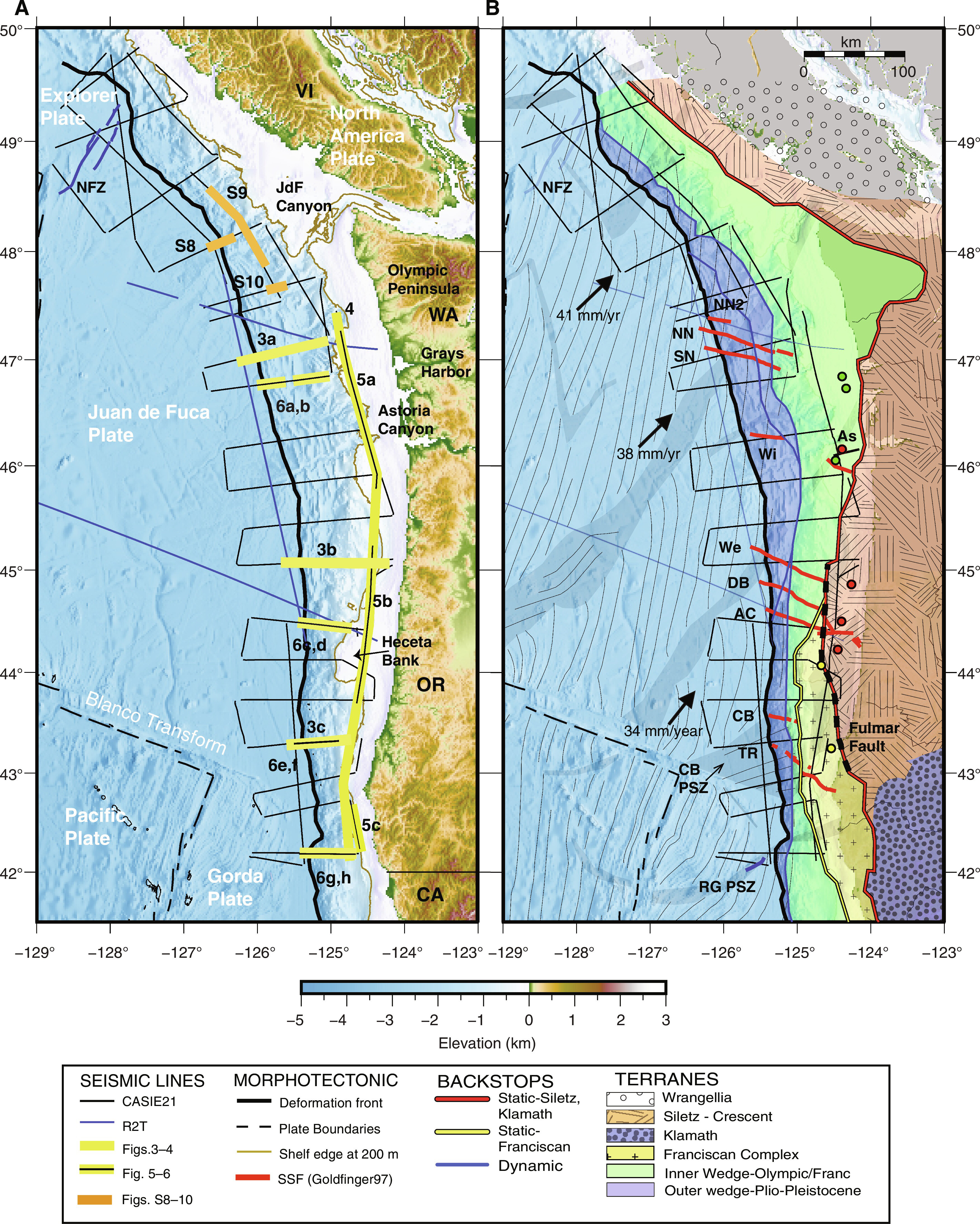
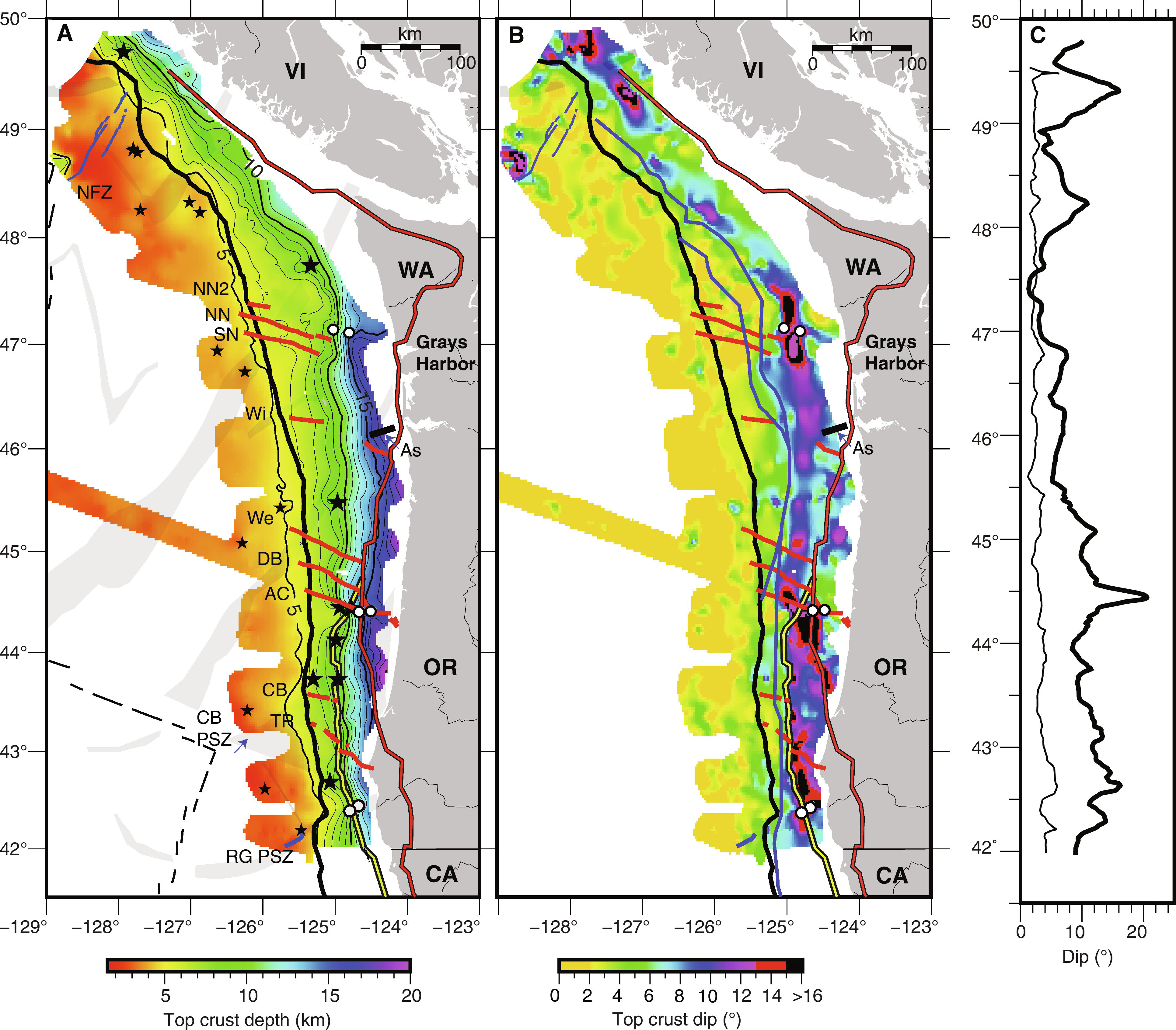
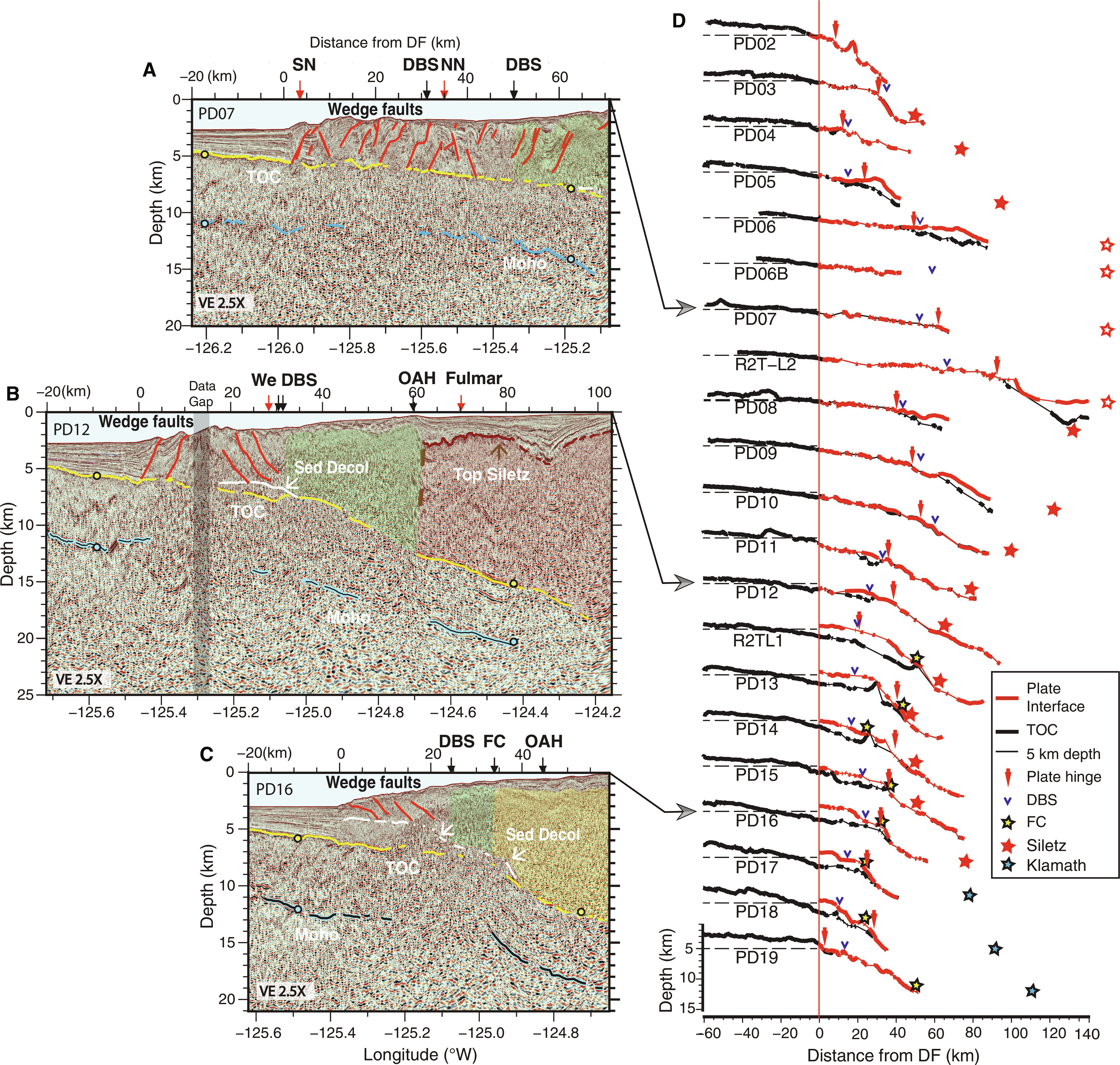
Auburn geophysicist Brian Boston was part of a team of scientists that spent 41 days offshore on a research expedition along this zone where two tectonic plates secretly slide past each other underwater. “Subducting plate structure and megathrust morphology from deep seismic imaging linked to earthquake rupture segmentation at Cascadia” is highlighted in the latest edition of Science Advances.
“The goal of our research is to help assess the risk for coastal communities in the Pacific Northwest,” said Boston, an assistant professor in the Department of Geosciences. “This information could help to clarify scenarios for earthquake damage and tsunami risks.”
The team consisted of more than 20 researchers using experiments and analysis to further enhance understanding of earthquake risk and behavior from the Cascadia Subduction Zone (CSZ).
“During the 41 days we sent down powerful sound pulses and carefully listened to the echoes back,” he explained. “These acoustic sounds helped us to determine where the megathrust fault exists and how an earthquake might propagate along this surface.”
And understanding where these earthquakes could take place presents challenges since, although scientists have studied this area for decades, this secretive subduction zone has provided little natural data for them to work with in the form of smaller earthquakes.
“One of the main reasons that scientists lack information about this zone is that small earthquakes can help you understand the geometry of the fault system,” said Boston. “However, this area has been quiet seismically, so an experiment like ours was needed to learn more about the potential risks.”
The last time this area had a major earthquake was in the 1700s. If a major earthquake occurred in this populated area currently, it could result in thousands of lost lives and billions in damages. An event of similar size caused the 2011 Fukushima nuclear disaster.
“One of our key findings was that the megathrust fault is segmented by big features such as other faults,” Boston added.
The presence of these segments might impede an earthquake from travelling the full length of the megathrust, a key question as the longer the rupture, the bigger the possible earthquake. However, Boston said more research is needed to fully understand the implications of these segments
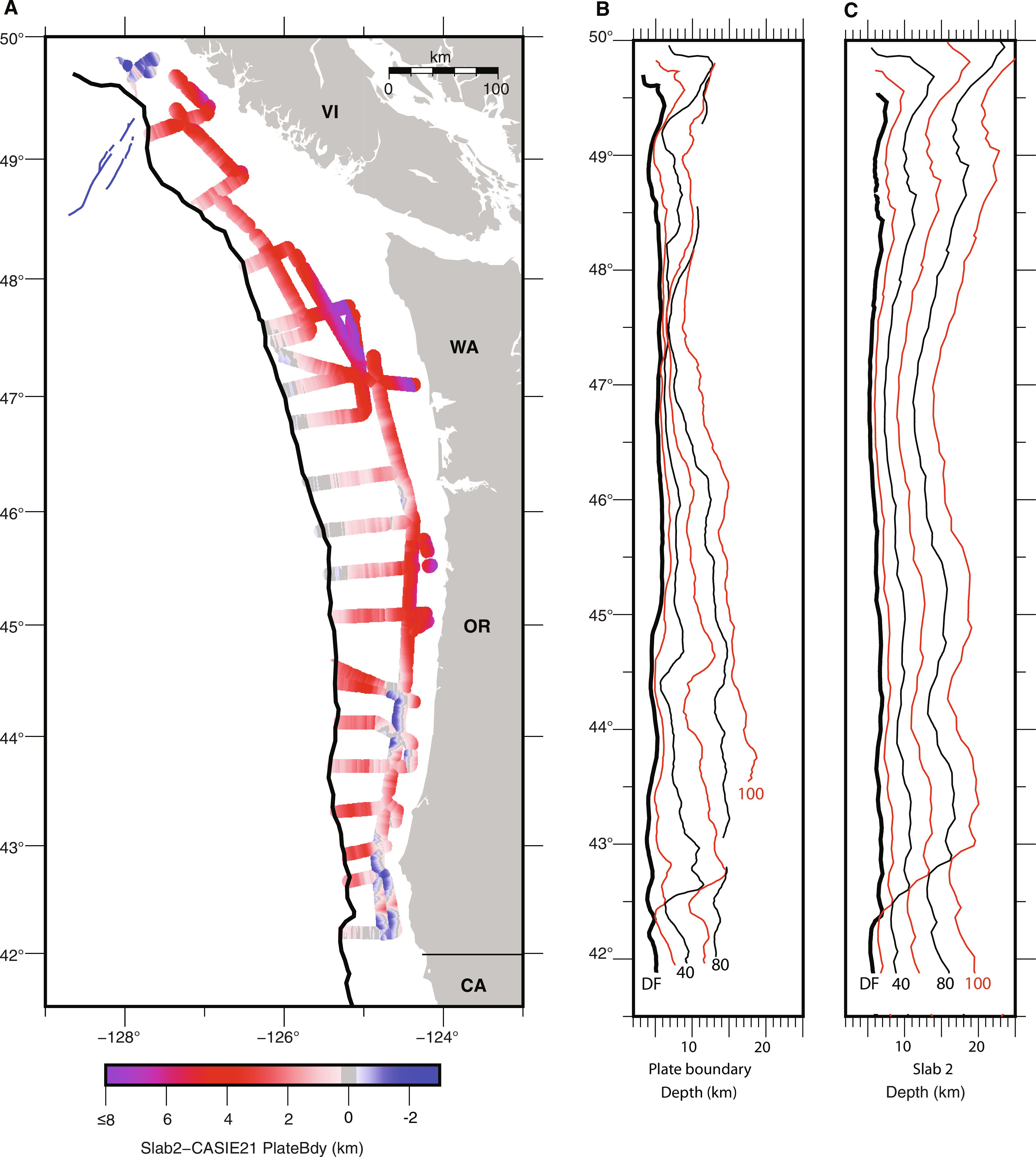
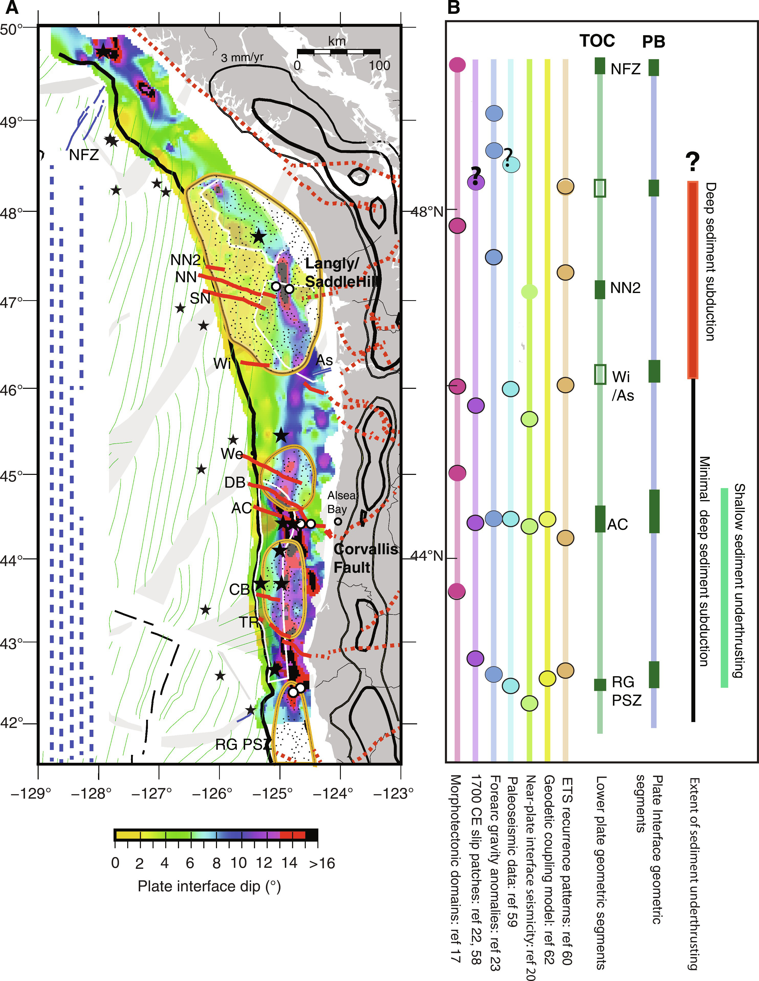
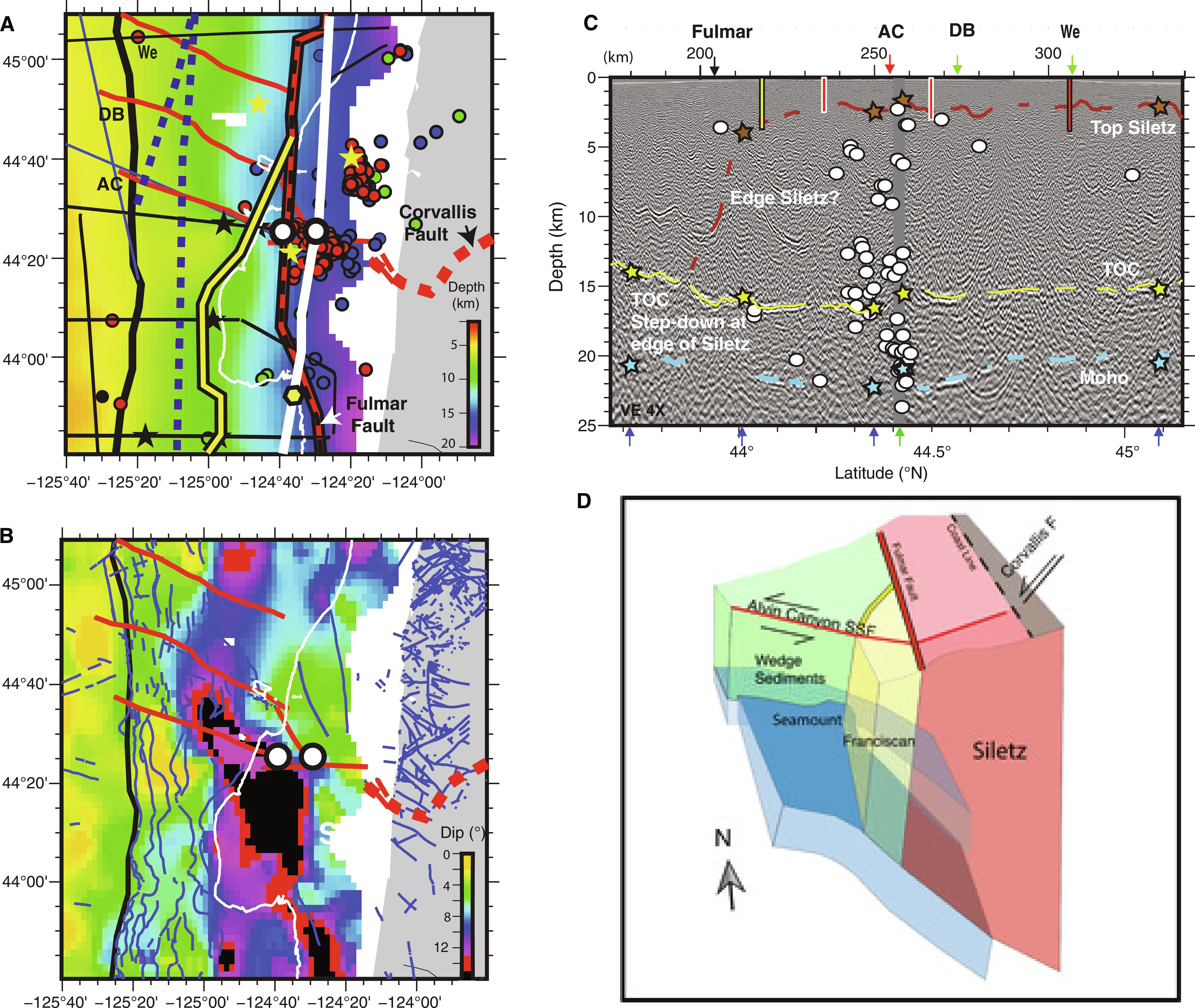
The researchers created detailed figures from their data including in-depth geometrical analysis. Learn more about this research in the six figures in the publication noted below:
- Figure 1: Survey coverage and tectonic framework of the Cascadia Subduction Zone
- Figure 2: Geometry of top of igneous crust surface along the Cascadia Subduction Zone
- Figure 3: Margin crossing seismic lines illustrating lower plate and plate interface fault geometry
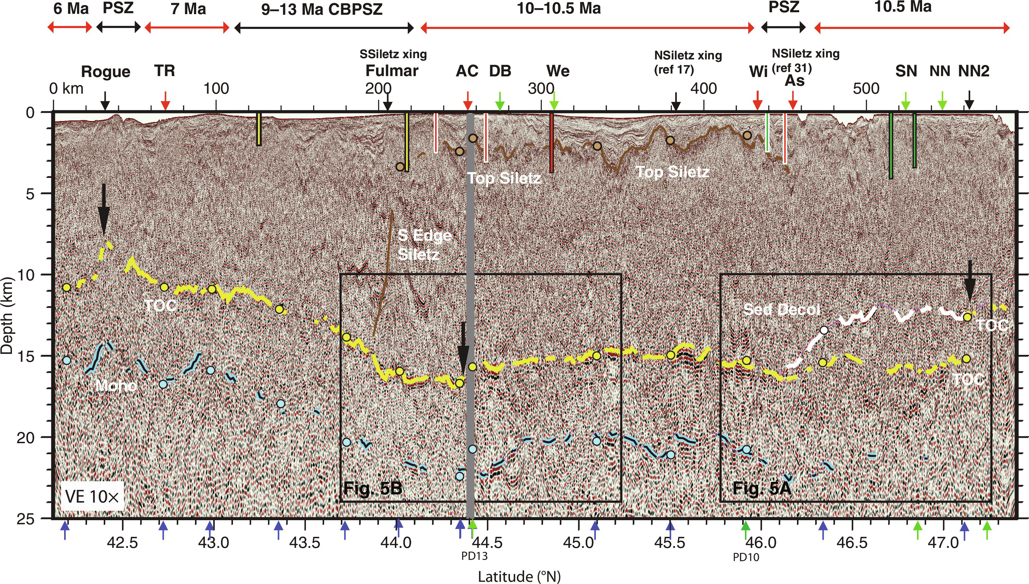
- Figure 4: Along-shelf seismic transect PS01with interpreted horizons for Top Oceanic Crust (TOC), Moho, Sediment Décollement and top of Siletz terrane
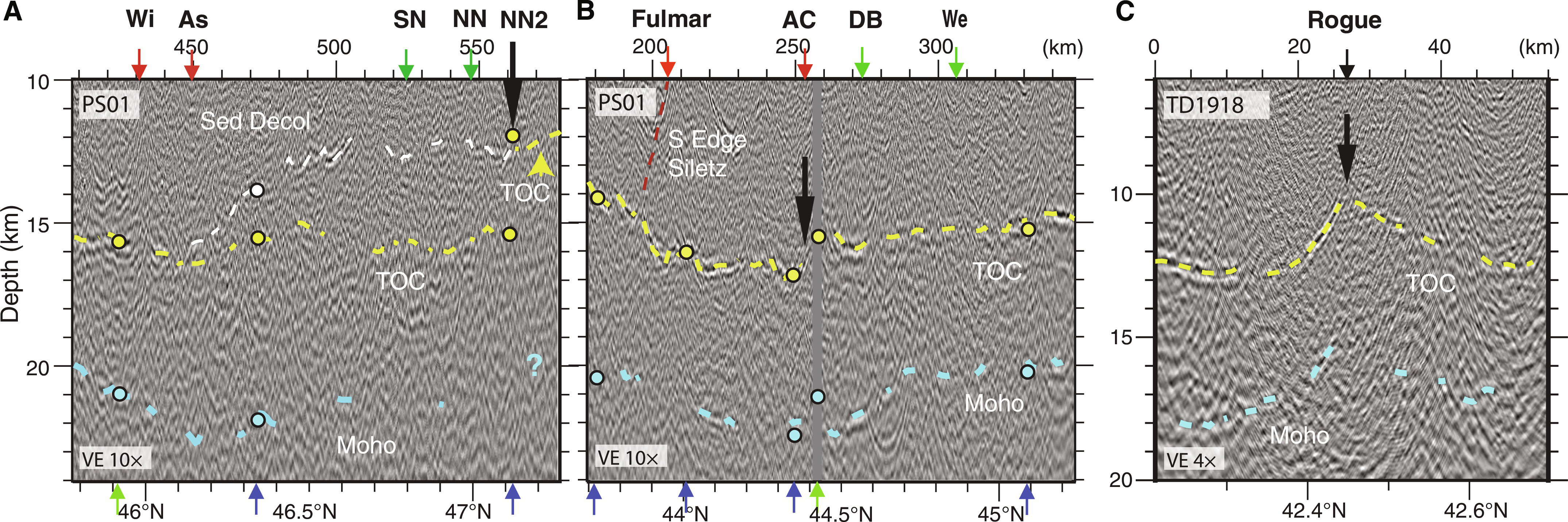
- Figure 5: Close-ups of margin-parallel seismic sections under the shelf with interpretations
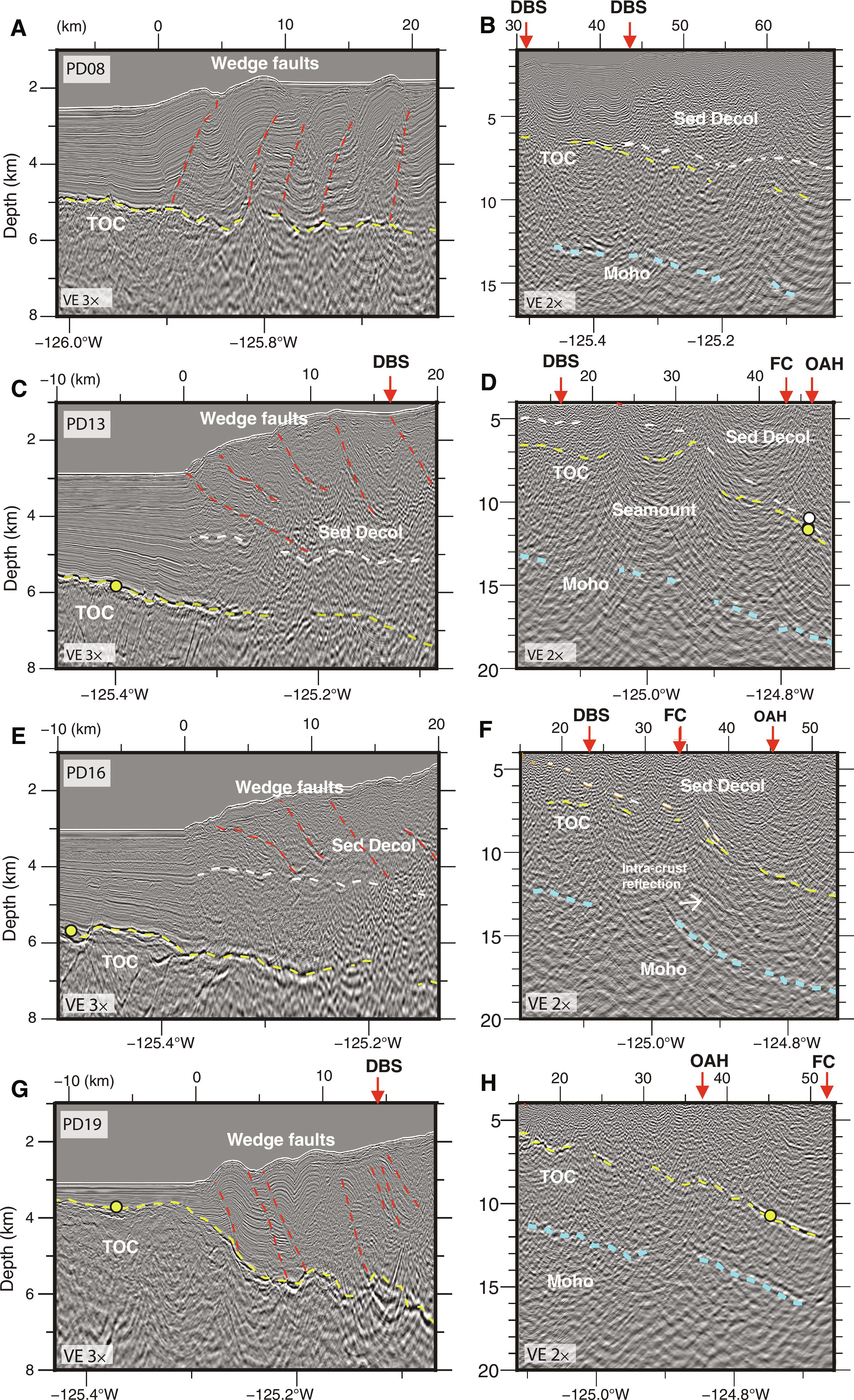
- Figure 6: Seismic images from margin crossing transects with interpretations
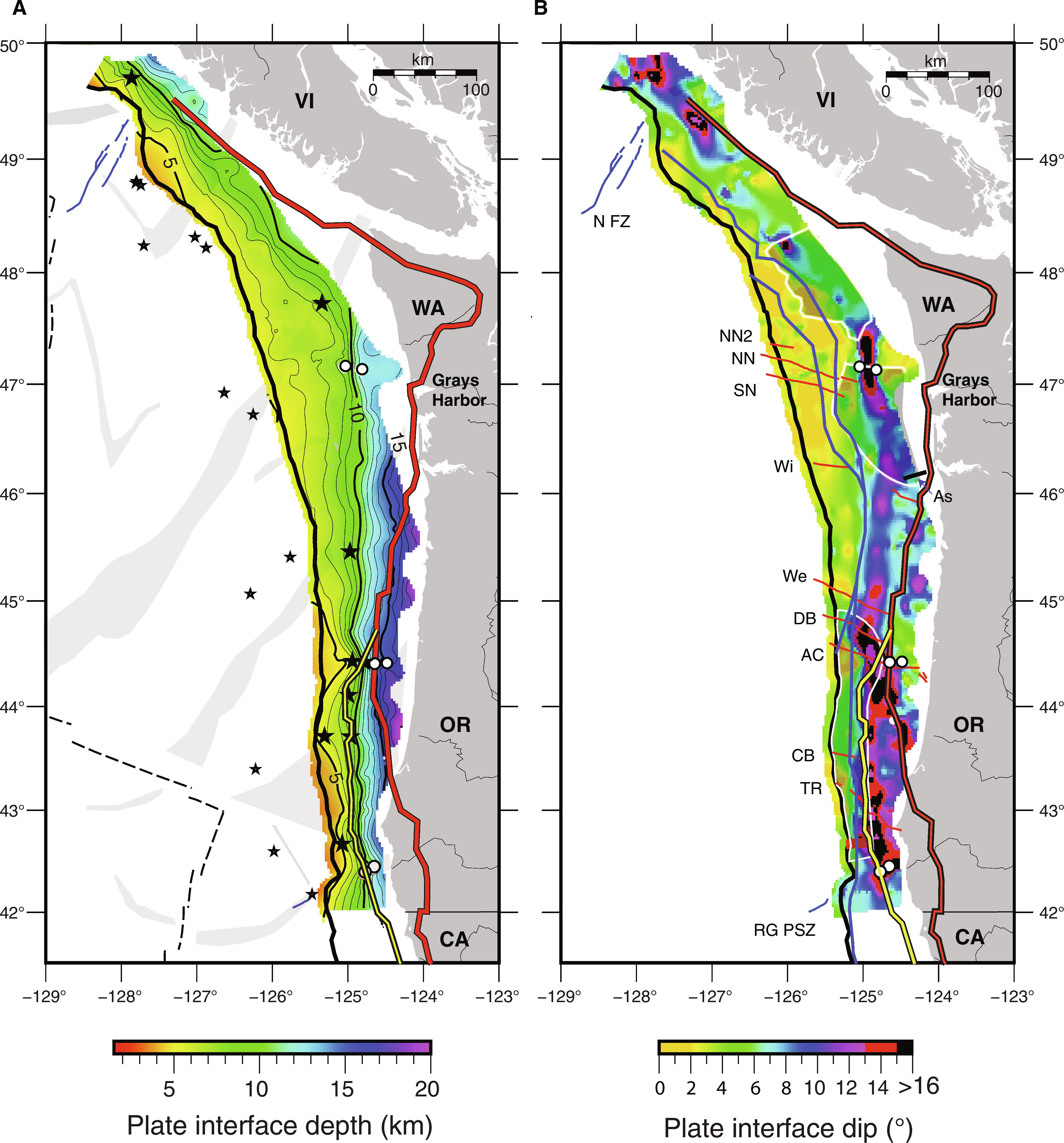
- Figure 7: Geometry of plate interface surface along the CSZ
- Figure 8: Comparison of CASIE21 plate interface geometry and prior regional plate model
- Figure 9: Comparison of geometry of plate interface with paleo-rupture history and slip behavior indicators
- Figure 10: Close-up of Alvin Canyon Strike Slip Fault region
For Boston, this research is his passion. He joined Auburn in 2022. Previously, he was an associate research scientist and postdoctoral research scientist at Lamont-Doherty Earth Observatory of Columbia University. He also was a postdoctoral researcher at the Japan Agency for Marine-Earth Science and Technology.
Boston earned his PhD at the University of Hawai‘i–Mānoa and his undergraduate degree from the University of Wisconsin–Madison.
Latest Headlines
-
06/17/2024
-
06/07/2024
-
05/31/2024
-
05/28/2024
-
05/28/2024
