COSAM News Articles 2012 October Internal grant triggers interdisciplinary work and multiple projects
Internal grant triggers interdisciplinary work and multiple projects
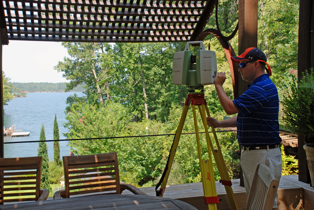
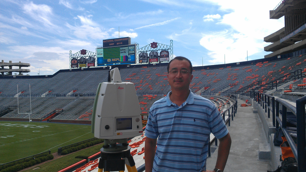
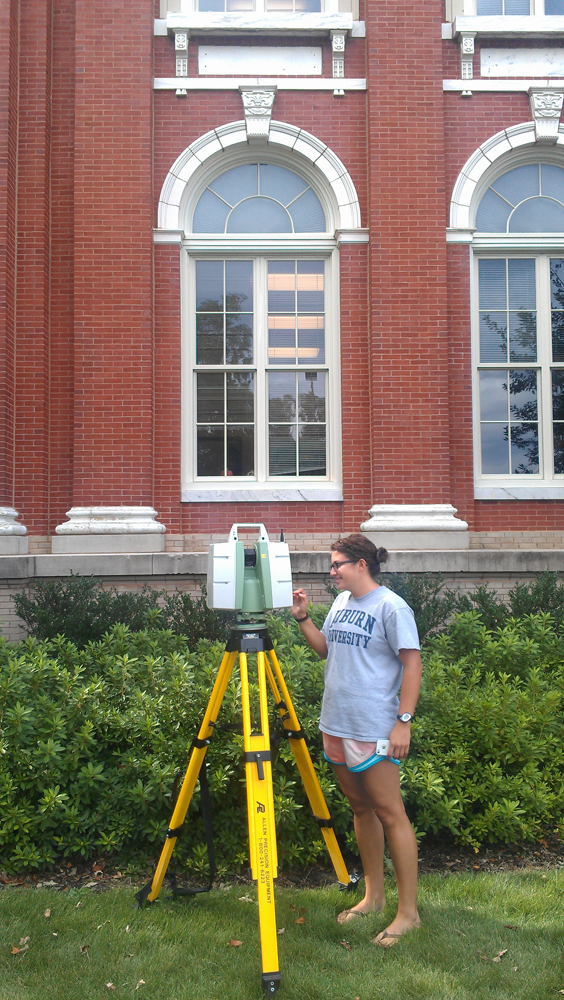
Luke Marzen, professor in the College of Sciences and Mathematics, or COSAM, and Art Chappelka, professor in the School of Forestry and Wildlife Sciences, or SFWS, spurred collaboration between Auburn University and the U.S. Geological Survey Alabama Water Science Center to produce an exact, three-dimensional model of the Toomer’s oaks. The model provided both a means of measuring the overall health of the trees, as well as documentation of the historic oaks. It was produced using a tripod-mounted laser scanner, also known as terrestrial light detection and ranging, or T-LiDAR. The T-LiDAR sends out a laser that scans anything within range and produces a three-dimensional replica.
After witnessing the results of the scan, Marzen, Chappelka and Paul Holley, Aderholdt Professor in the College of Architecture, Design and Construction, or CADC, realized that the T-LiDAR equipment could prove useful in a variety of ways in their various disciplines. As a result, the three joined forces and wrote an interdisciplinary request for funding to purchase T-LiDAR equipment for Auburn University.
The request was approved through an internal grant program promoting interdisciplinary research through Auburn’s Office of the Vice President for Research, and included cost sharing from COSAM, SFWS and CADC.
Because a T-LiDAR scanner can produce three dimensional models of most anything, Marzen, Chappelka and Holley will use the equipment for a variety of projects.
Currently, Marzen and Chappelka are collaborating on a project funded by the USDA Forest Service titled, “Using T-LiDAR to determine crown area and density, and above-ground biomass.” The research will investigate ways the scanner can be used to collect detailed information about trees, or forest metrics. Because of the detail the equipment offers, they will have the ability to effectively monitor and inventory forests and assess many metrics such as crown architecture and density, as well as total biomass. These factors can then be used to better estimate ecosystem services such as carbon sequestration, carbon storage, energy savings and air pollution removal.
Marzen conducts research focused on water resources, so he also hopes to use the equipment to look at local watersheds and streams and monitor erosion. Additionally, he is in discussion with the Alabama Department of Economic and Community Affairs about the possibility of using the equipment to assess dam stress.
“I have also been talking with some folks in Civil Engineering about using the scanner to help measure the movement of a soon-to-be-built new bridge,” Marzen said. “There are many applications for this equipment that can apply to many disciplines.”
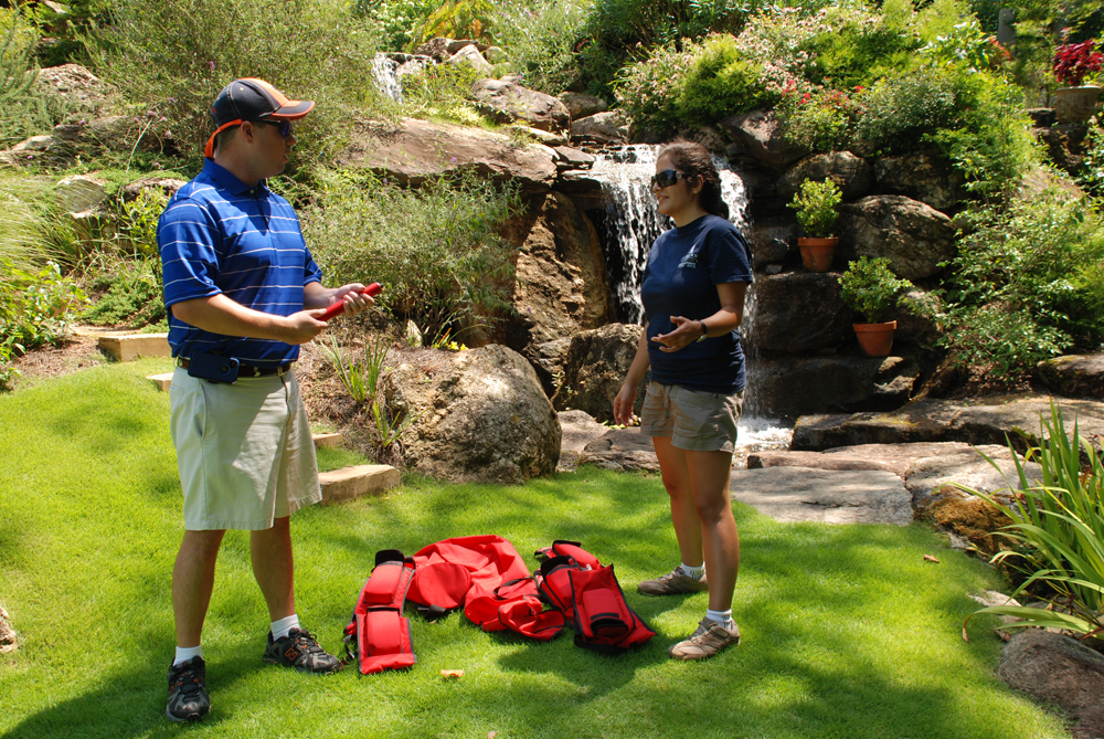
Students have also had an opportunity to use the equipment. Graduate students Tyler Jones and Batoul Damghani, both in the department of Geology and Geography, were in Marzen’s Geographic Information Systems class. They were tasked with the assignment to map a property using the scanner - in addition to GPS mapping - along the shores of Lake Martin, Ala. The property, owned by Montgomery, Ala., attorney, Jim Scott, consists of a diverse and extensive garden, replete with waterfalls and water features, hidden dining areas, playgrounds, a massive pavilion, bridges and walking paths, and lush vegetation. The students were able to practice using the equipment, and Scott received a detailed map of his landscape.
“This was a good opportunity for us to see how well the equipment works on a very diverse landscape,” Marzen said.
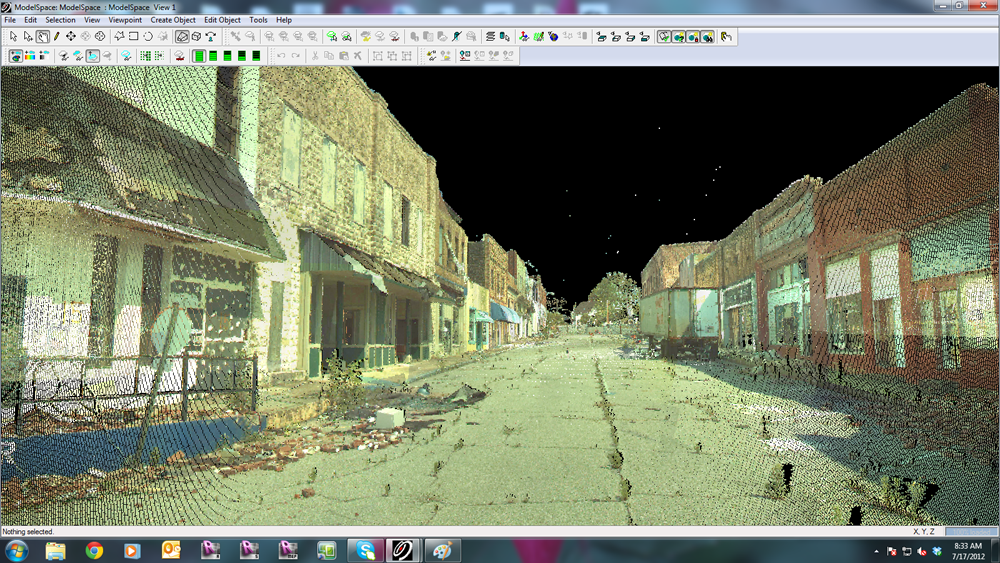
Graduate students in CADC have gained experience using the T-LiDAR equipment as well. As part of graduate student projects, Holley oversaw a team of students using the scanner in the Cordova, Ala., community, which was devastated by the tornado outbreak in April 2011. Using the scanner, students were able to accurately capture an image of the downtown area. The image helped them strategize on a rebuilding effort (full story at this link: http://ocm.auburn.edu/featured_story/cordova.html).
Holley is also working with Facilities and other groups on campus to use the equipment for projects related to structure restoration and/or building additions.
“As we are becoming versed in the use of the equipment and the manipulation of the data it captures, we plan to soon apply for grants in which scanning can greatly help capture significant amounts of data for buildings and their surroundings,” Holley said. “We hope this also presents opportunities for research across disciplines, and are working with Landscape Architecture and Industrial Design in that regard.”
Latest Headlines
-
02/12/2025
-
02/11/2025
-
02/10/2025
-
01/30/2025
-
12/03/2024
